I am sorry, my answer is wrong

. Getmef.exe is for radars only, for other POIs use diggerQt.exe.
For example, Category 480 CZ-Pivovar (Brewery).
Save CSV File for iGO.
- save_csv_for_igo.png (60.92 KiB) Zobrazeno 29568 x
Open this CSV file in Excel and save it to xls file (e.g. CZ-pivovary.xls).
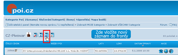
Now start diggerQt.exe and create new import CZ-Pivovar. Select Driver type Microsoft Excel Driver (XLS) and open file CZ-pivovary.xls.
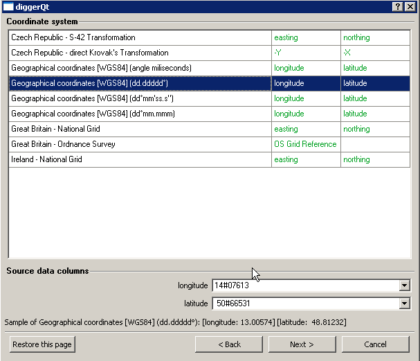
Select Coordinate system and columns for longitude and latitude.
- coordinate system.png (11.46 KiB) Zobrazeno 29564 x
Convert icon for this category "CZ-pivovar.bmp" from this site to "CZ-pivovar.png". In next screen, select image for icon CZ-pivovar.png.
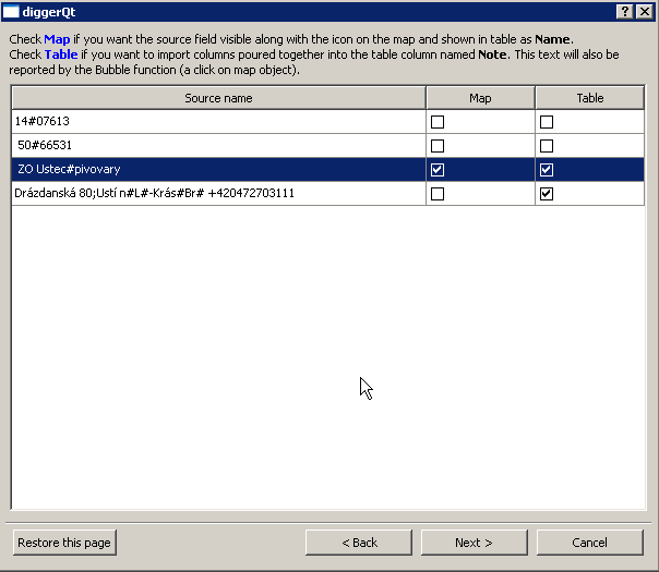
In next step, select source fields for map and table.
- source fields.png (7.82 KiB) Zobrazeno 29565 x
Save configuration and run import. Now, in the directory wirh MapFactor PC Navigator on PC is "import" directory with "CZ-Pivovar" subdirectory. Copy "import" directory from PC to PDA-directory with map, in my PDA e.g. CR-TA on SD-Card.